One of the aerial montage’s greatest strengths is its flexibility. It can be used in a variety of contexts, whether for planning or marketing, and either on its own or as part of a wider visual strategy. It plays a key role in helping teams communicate unbuilt developments clearly and effectively, adding value to both technical planning submissions and promotional materials.
And while some may argue that no one will ever actually see a development from such a high viewpoint, the use of accurate aerial representations is only growing, especially among property developers, architects, estate agents, and other design team consultants. In this article, we take a closer look at what aerial montages are, how they’re created, and the top benefits they bring to a project.
What are Aerial Montages?
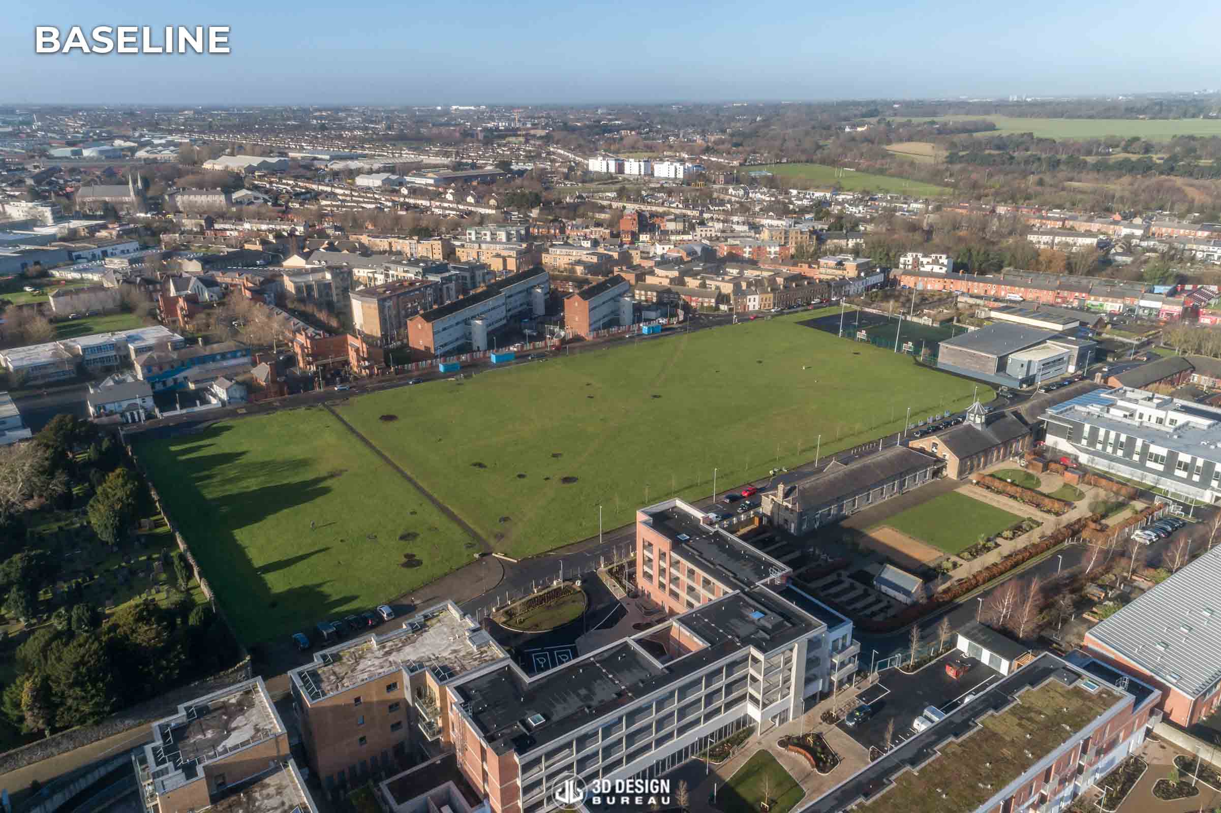
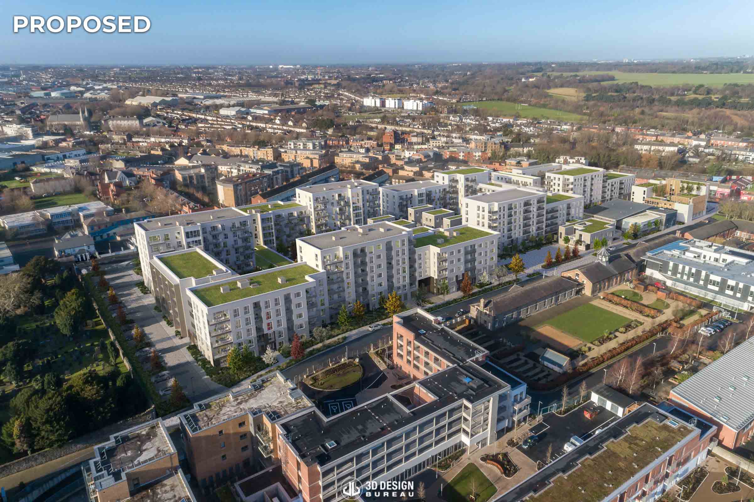
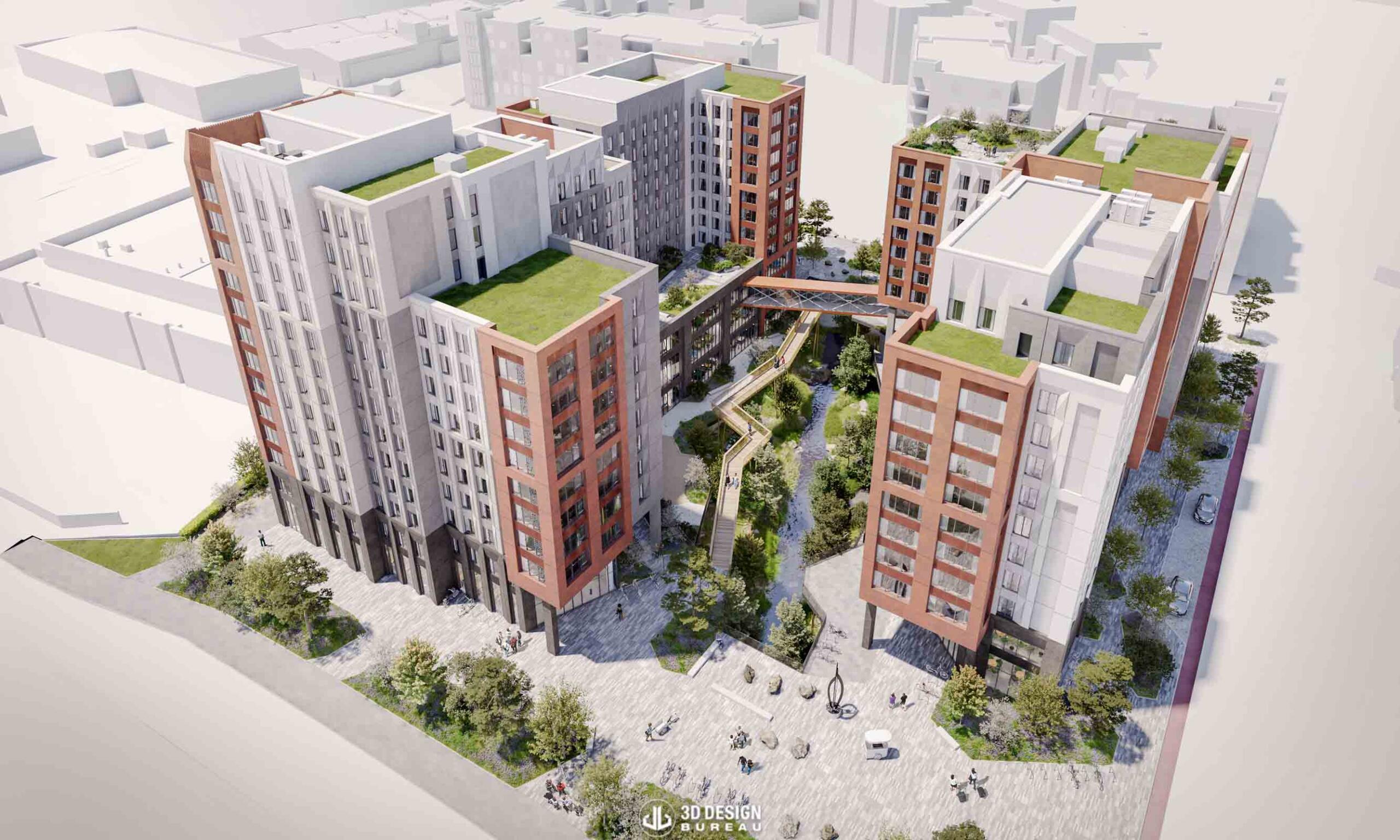
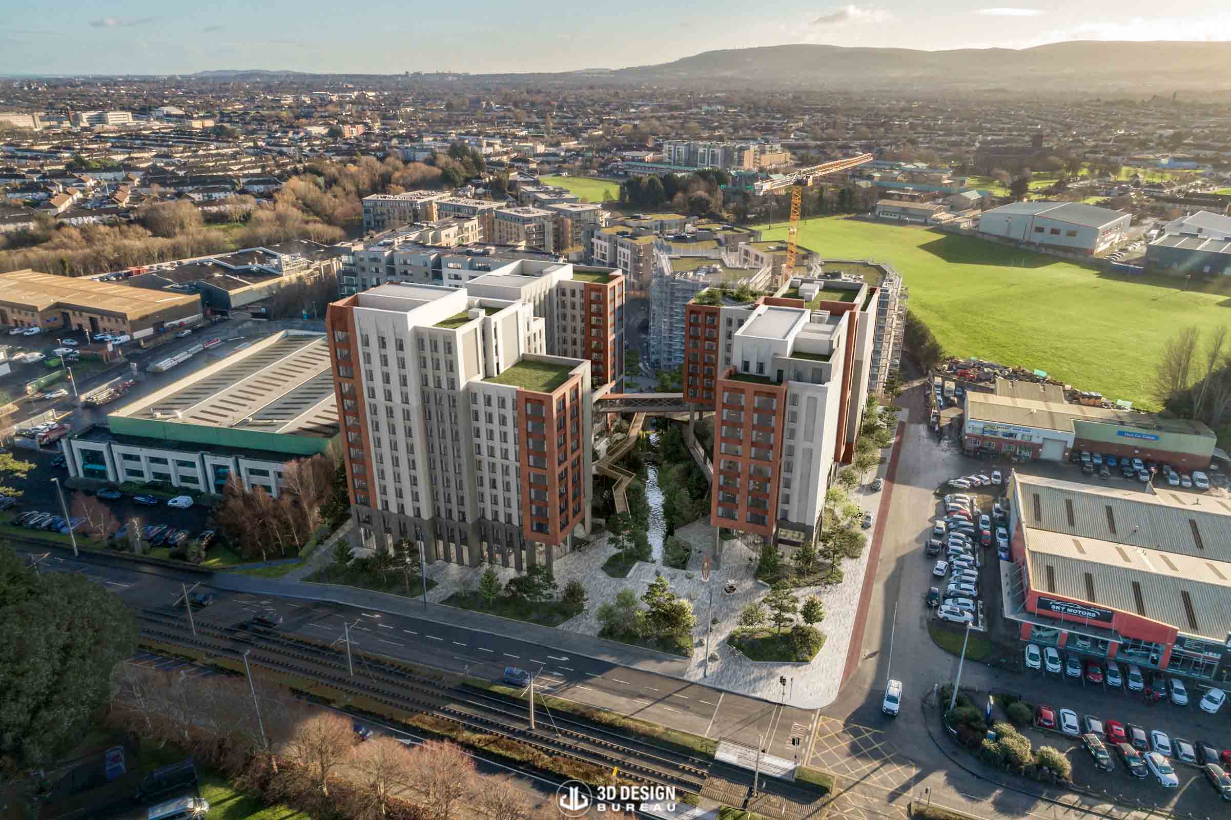
Aerial montages, also known as aerial CGIs, showcase a proposed property development from a bird’s-eye perspective. They combine carefully positioned aerial photography with a 3D representation of the development, clearly illustrating the site’s layout, location, and how the scheme integrates with its surrounding environment. This benefits both property planning and marketing strategies.
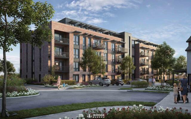
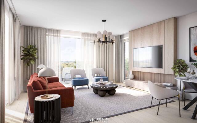
Additionally, because creating an aerial montage requires modelling the entire site, it facilitates the production of additional visuals, such as eye-level CGIs showcasing the development or its open space amenities, adding value to the project.
How are Aerial Montages created?
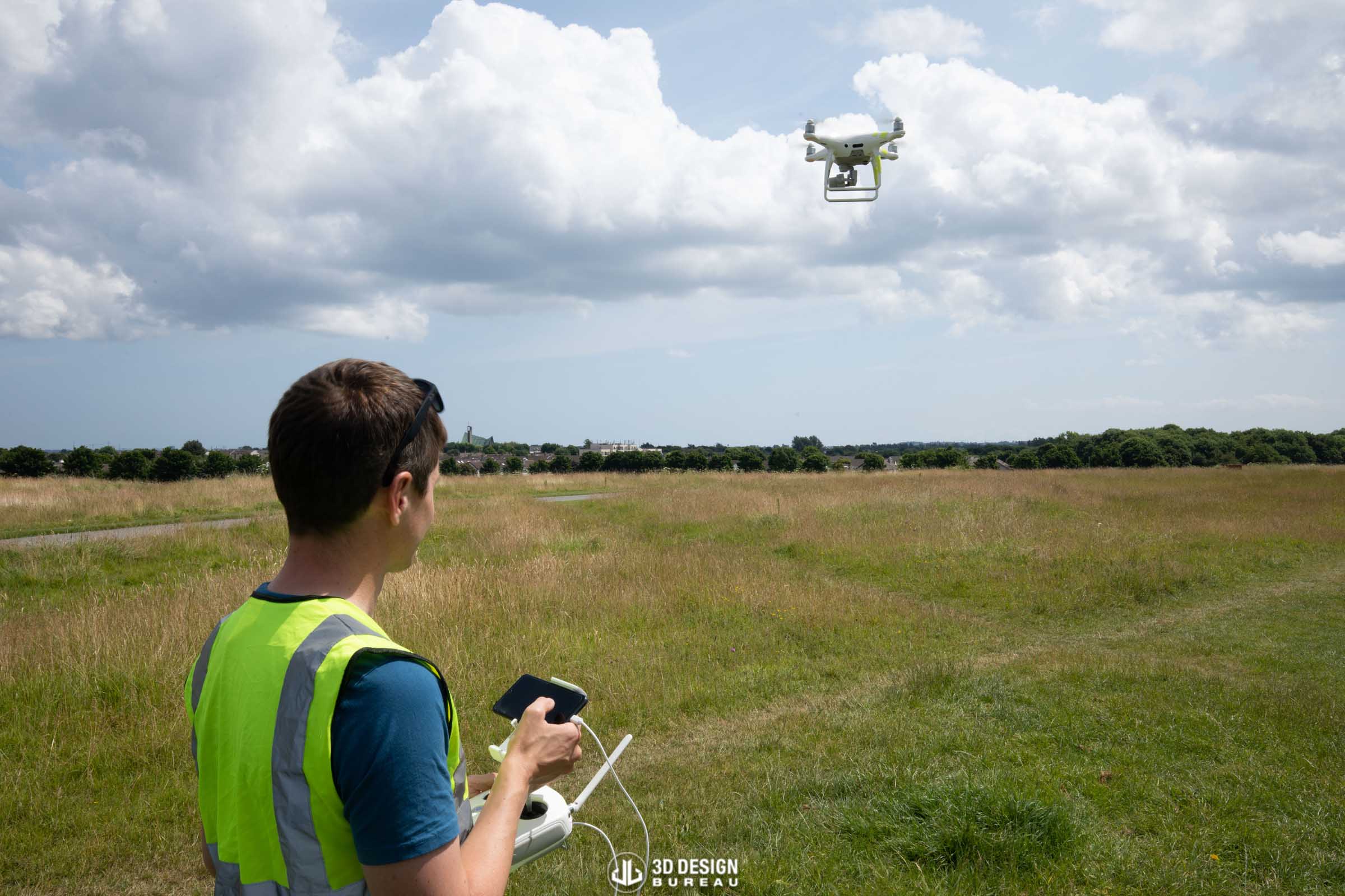
The key to producing high-quality aerial montages lies in a well-planned photo site visit. Before heading to the site, we collaborate closely with the design and/or sales teams to ensure the correct viewpoints and angles are identified in advance. It’s essential that all proposed views are signed off prior to the shoot to avoid the need for costly and time-consuming return visits should the brief change later on.
3DDB’s photographer and drone pilot, Richard Buggy, emphasises that, “in drone photography, capturing every viewpoint and ensuring safe flights is essential. This is achieved with meticulous pre-planning of subject sites and their surroundings, the weather on the day, the time of year (high and low sun positions) and the airspace restrictions.”
Once aerial photography is captured, our team begins creating the 3D model of the proposed scheme using Autodesk Revit. This model is built from a combination of architectural, engineering, and landscape drawings provided by the design team.
Much like in verified view montages, our team performs camera matching in 3ds Max using information collected during the baseline photographic site visit, including camera coordinates, angle of view, and direction of view. This enables us to accurately position the 3D model within the context of the site. Our visualisation team then renders the scene, applying realistic textures, lighting, and contextual elements to closely represent the intended ‘as-built’ look of the development.
In projects where we did not produce verified view montages, our team uses all available information to position the model as accurately as possible. When necessary, we refine the placement manually, with careful attention to perspective and scale, to ensure a high-quality result.
Early low-resolution drafts are issued to assess the model’s placement within the aerial photography and to gather feedback from clients, allowing for adjustments before progressing to the final stages of production. Ultimately, in post-production, our team enhances the visuals in Photoshop, applying colour grading, atmospheric effects, and final refinements. The result is a high-resolution, photorealistic aerial render ready for planning submissions or marketing materials.
Top benefits for property planning & marketing
When submitted alongside verified view montages, aerial montages serve as a powerful tool for planning applications. They clearly communicate the scale and context of a proposed development, helping local authorities assess its potential impact on the surrounding environment and make more informed decisions.
However, it’s within marketing strategies that aerial montages truly shine. They enable property developers and agents to provide prospective buyers or tenants with a clear understanding of the site’s overall layout and location. These visuals can also highlight nearby attractions or key amenities, making them particularly effective for off-plan virtual tours and architectural animations.
Take the Gowan House project as an example. We created several aerial montages to showcase the public amenities planned for the site, drawing particular attention to the River Cormac, which is a visible and important element of the project. These visuals not only supported the planning process, assisting our client in securing planning permission for it, but also will be repurposed to effectively market the development.
In the architectural animation, the aerial views give particular highlights to the development connections, showcasing its excellent public transport links to Dublin City Centre. Learn more about the behind-the-scenes of creating these visuals for Gowan House here.
In conclusion, the flexibility of aerial montages makes them a powerful visual tool that adds significant value to any project. As technology continues to evolve, aerial montages will no doubt play an even greater role in how developments are planned and brought to market.
Whether you need high-quality visuals for your unbuilt residential or commercial property development, 3D Design Bureau has got you covered. Book a free presentation today or get in touch to understand how we can assist you in your next project.
Author:
Lucas Imbimbo Digital Marketing Specialist at 3D Design Bureau lucas@3ddesighbureau.com
The Benefits of Architectural CGIs for Property Planning and Marketing
What are Architectural CGIs? | How are Architectural CGIs created? | Top benefits for property design & marketing | Conclusion The use of 3D renderings in architecture has evolved from a luxury […]
3DDB’s Managing Director, Nicholas Polley, Named in Business Post’s Property 100
Nicholas Polley, Managing Director of 3D Design Bureau, has been named in the Business Post’s inaugural Property 100 Index, published in April 2025. The list highlights individuals identified as “visionaries, strategists and investors who balance bold ambition with calculated risk” in Ireland’s property sector.
Home Performance Index: How Daylight & Sunlight can help you get certified
In a landscape where sustainability affects our built environment, governments are setting ambitious climate action targets, and consumers are becoming increasingly conscious of environmental impact when making decisions, the Home Performance Index (HPI)certification helps design teams deliver high-quality homes that are sustainable and efficient, minimising waste and reducing environmental damage.
We use cookies to ensure that we give you the best experience on our website. If you continue to use this site we will assume that you are happy with it.OkPrivacy policy